


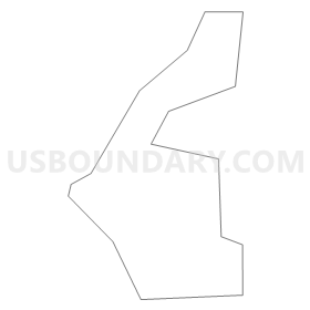
Voting District 4641, Salt Lake County, Utah
About
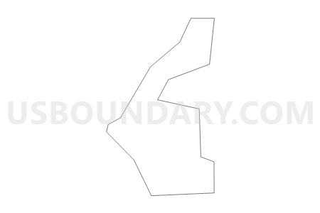
Outline
Summary
| Unique Area Identifier | 679664 |
| Name | Voting District 4641 |
| County | Salt Lake County |
| State | Utah |
| Area (square miles) | 0.30 |
| Land Area (square miles) | 0.30 |
| Water Area (square miles) | 0.00 |
| % of Land Area | 100.00 |
| % of Water Area | 0.00 |
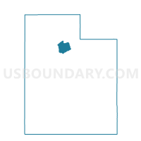
| Latitude of the Internal Point | 40.57941460 |
| Longtitude of the Internal Point | -111.91494460 |
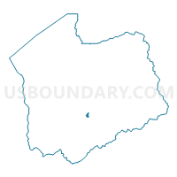
Maps

Graphs
Select a template below for downloading or customizing gragh for Voting District 4641, Salt Lake County, Utah


Neighbors
Neighoring Voting District (by Name) Neighboring Voting District on the Map
- Voting District 3426, Salt Lake County, UT
- Voting District 3467, Salt Lake County, UT
- Voting District 3518, Salt Lake County, UT
- Voting District 3520, Salt Lake County, UT
- Voting District 4530, Salt Lake County, UT
- Voting District 4644, Salt Lake County, UT
- z Unpopulated 8461A, Salt Lake County, UT
Top 10 Neighboring County Subdivision (by Population) Neighboring County Subdivision on the Map
Top 10 Neighboring Place (by Population) Neighboring Place on the Map
Top 10 Neighboring Unified School District (by Population) Neighboring Unified School District on the Map
Top 10 Neighboring State Legislative District Lower Chamber (by Population) Neighboring State Legislative District Lower Chamber on the Map
Top 10 Neighboring State Legislative District Upper Chamber (by Population) Neighboring State Legislative District Upper Chamber on the Map
Top 10 Neighboring 111th Congressional District (by Population) Neighboring 111th Congressional District on the Map
Top 10 Neighboring Census Tract (by Population) Neighboring Census Tract on the Map
- Census Tract 1126.05, Salt Lake County, UT (6,795)
- Census Tract 1128.17, Salt Lake County, UT (6,374)
- Census Tract 1130.12, Salt Lake County, UT (4,854)
- Census Tract 1124.03, Salt Lake County, UT (4,473)
- Census Tract 1142, Salt Lake County, UT (4,419)